Otway Basin and the Shipwreck Coast, Victoria
Extract from National Rock Garden Newsletter No. 6, July 2013
Adapted from Geoscience Australia and Parks Victoria information
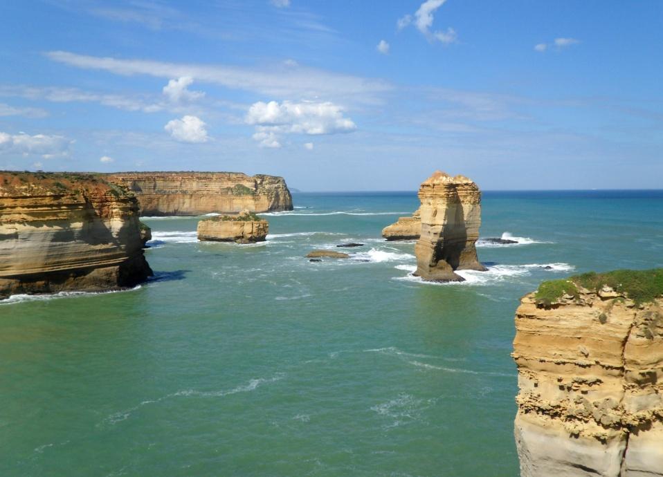
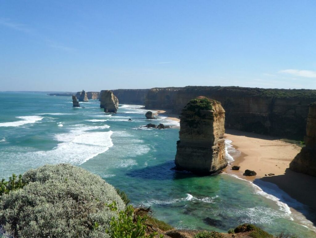
The limestone coastline of South Australia and south west Victoria is known as the Shipwreck Coast. This section of coastline is made up of spectacular cliffs, reefs, islands and outcrops of rocks. In combination with the winds of the’ roaring forties’ and the often stormy seas, sailing these waters up until the middle of the 20th century could be very dangerous. Along a 130 kilometre stretch of the Victorian coast from Port Fairy to Cape Otway alone there are over 80 shipwrecks.
The Historic Shipwreck Trail along the Shipwreck Coast and the Discovery Coast of southwest Victoria shows some of the sites where gales, human error and, in some cases, foul play caused these vessels to be wrecked. A tourist car drive along Victoria’s Great Ocean Road reveals some of this spectacular coastal cliff scenery including the Twelve Apostles, a group of sea stacks near Port Fairy.
The coastal cliffs reveal something of the geology of the Otway Basin that stretches from South Australia to Cape Otway in Victoria. The Otway Basin is a large, northwest trending sedimentary basin on Australia’s southern margin with the Southern Ocean. The basin formed when the Australian continent began rifting away from the Antarctic continent during the Late Jurassic geological epoch (about 150 million years ago). The early continental rifting of the Gondwana super-continent resulted in the east-west trending onshore centres of sediment deposition that comprise the Inner Otway Basin.
Subsequently, renewed rifting during the Late Cretaceous geological epoch culminated in continental breakup of the Gondwana super-continent in the Maastrichtian geological age (about 72-66 million years ago). This produced northwest-southeast trending depocentres beneath the Australian offshore outer continental shelf and slope under the Southern Ocean. Multiple phases of compression in the Cretaceous, Neogene and Quaternary geological periods (since about 65 million years ago) resulted in inversion and wrenching of pre-existing geological structures. The Otway Basin has a maximum total sediment thickness of about 13,000 metres.
The Otway Basin is prospective for oil and gas both onshore and offshore. The most significant hydrocarbon occurrences in the Otway Basin are the gas fields (onshore / offshore) in Early and basal Late Cretaceous reservoirs in Victorian and South Australian parts of the basin. Most gas accumulations have a low condensate content, but some occurrences contain a high proportion of carbon dioxide.
Production of natural gas from the Victorian onshore fields supplies domestic and industrial users in western Victoria through a 200 kilometre (km) gas pipeline network. An additional 130 km of gas pipeline links the Otway Basin network back to Lara and hence to the Victorian and South East (SE) Australian gas network. Depleted onshore fields in the Port Campbell area are used for underground gas storage to supply gas during peak demand periods.
What the tourists see along the Great Ocean Road and the Shipwreck Coast are the beautiful cliffs associated with the geologically quite young (less than 27 million years old) Heytesbury Group of rocks that include the Port Campbell Limestone (15 to 5.5 million years old). This rock group has been eroded by sea level rise since the last ice age maximum 21,000 years ago to form the diverse rock formations and cliffs we see today.